


A cold front will slide across the region late Wednesday. Ahead of the front two rounds of storms may include isolated severe storms.
Expect gradually increasing clouds through the day today as temperatures climb to the 70s and 80s this afternoon. Dry conditions are expected for many through the day before rain chances increase this evening and tonight. There's a low rip current risk at all North Carolina beaches today.
Isolated to widely scattered showers and storms will be possible tonight through tomorrow morning in the first of two possible rounds of storms. The second round will begin early in the afternoon Wednesday and end by the late evening. During this time an isolated severe storm capable of producing damaging winds, quarter-sized hail and a brief tornado cannot be ruled out, so remain weather aware.
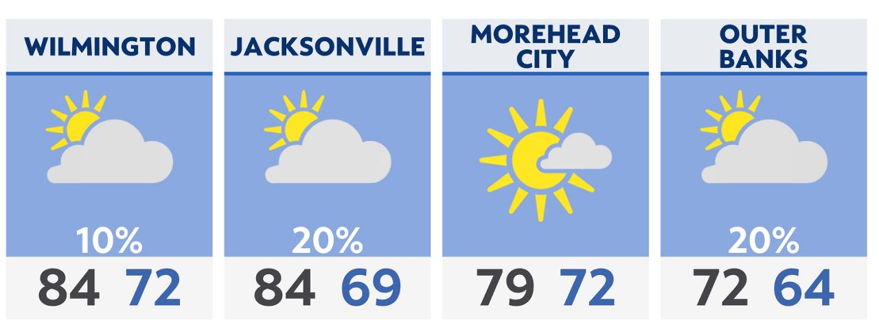
Here's the 5-day forecast for Wilmington:

Check radar and the latest 7-day forecast | Share your weather photos