


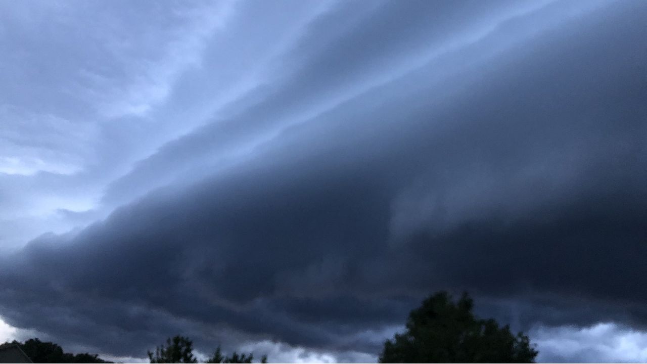
RALEIGH, N.C. -- If you have outdoor plans Friday evening, you will want to keep a close eye on radar. Another round of thunderstorms is expected across central North Carolina from late afternoon through the night. The storms should be more numerous compared to the last few days and could be stronger.
The Storm Prediction Center has outlined most of the region for a level 1 to 2 risk for severe storms. The greatest threat from any severe storms will be damaging wind gusts up to 60mph that could be strong enough to down trees and cause spotty power outages.

Any storm that forms late Friday could also produce locally heavy rain. Much of the area should see around one to two inches of rain. Localized amounts up to three inches are possible with the strongest storms. Frequent lightning will also be a concern.
The storms could delay or postpone many outdoor plans Friday including high school football games. If you are outdoors this evening and hear thunder, seek shelter inside as quickly as possible. The sound of thunder is an indication that you are close enough to a storm for the next lightning strike to possibly strike your location.
- Interactive radar
- Follow storms as they develop with the Spectrum News app
- Sign up for text weather alerts
The first storms of the day should form after 3pm. The threat for storms will then continue through much of the night. Our meteorologists may still be tracking storms through 2am Saturday morning.


- Share your weather photos with Meteorologist Lee Ringer on Facebook
- Tweet your weather reports to @LeeRingerWx on Twitter
Friday night's storms will be forming ahead of a cold front that will slowly move across the Carolinas into the weekend. That front will bring cooler weather and will push the highest rain chance for Saturday and Sunday to the coast and into South Carolina. Spotty light to moderate showers will still be possible for both Saturday and Sunday. Otherwise, much of the weekend will be mostly cloudy. Saturday's highs may only reach the mid to upper 70s. Sunday will warm to just 80.